
-
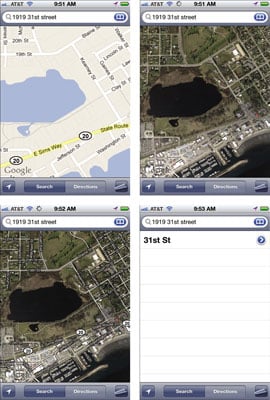
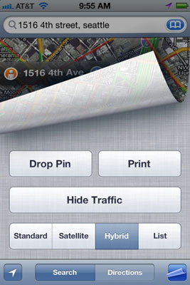
To change views, with Maps open, tap the Settings button in the bottom-right corner of the screen to turn the page, so to speak, and reveal the Maps menu.
-
Tap the Satellite option. The Satellite view appears.
-
Tap the Settings button to reveal the menu again, and then tap Hybrid.
In Hybrid view, Satellite view is displayed with street names superimposed.
-
Finally, tap the Settings button to reveal the menu one more time, and then tap List.
A list of locations on the map is displayed.
On the Maps menu, you can also access a Traffic overlay feature. If you live in a larger metropolitan area (this feature doesn’t really work in small towns), turn on this feature by tapping the Show Traffic button.
The traffic overlay shows different colors on roads indicating accidents or road closures to help you navigate your rush hour commute or trip to the mall. Green tells you you’re good to go, yellow indicates slowdowns, and red means avoid at all costs.To print any displayed map to an AirPrint-compatible wireless printer, just tap the Print button on the Maps menu.