
The Street level view on iPad's Maps application is seriously cool. You can not only get a picture of what the location looks like from the street, you can pan all around it to look up at tall skyscrapers, around to get a feel for the neighborhood, or down to see the actual street. You can only view certain locations from street level, so you'll have to explore to try this out.
If you want to give it a try, follow these steps and use the Monorail Westlake Center in Seattle to explore one location at street level:
In the Search tab of Maps, tap the Search field and enter a location, such as your favorite local shopping mall.
Enter Monorail Westlake Center if you have trouble finding a location that offers a street level view, indicated by a little red icon on the information bar for the location.
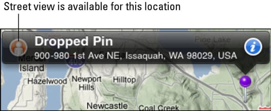
When the location appears, tap the Street view icon on its information bar.
When you're in Street view, you can tap and drag the screen to look around you in all directions.
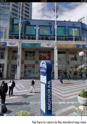
Tap the small circular map in the bottom-right corner to return to the standard map view.
You can also drag the screen down to get a better look at tall skyscrapers or up to view the street and manhole covers. The small circular map in the bottom-right corner highlights which direction you're facing in Street view. In addition, street names are displayed down the center of streets.